Marine Fuel Stations in Croatia: Interactive Map and Nearest Fuel Dock
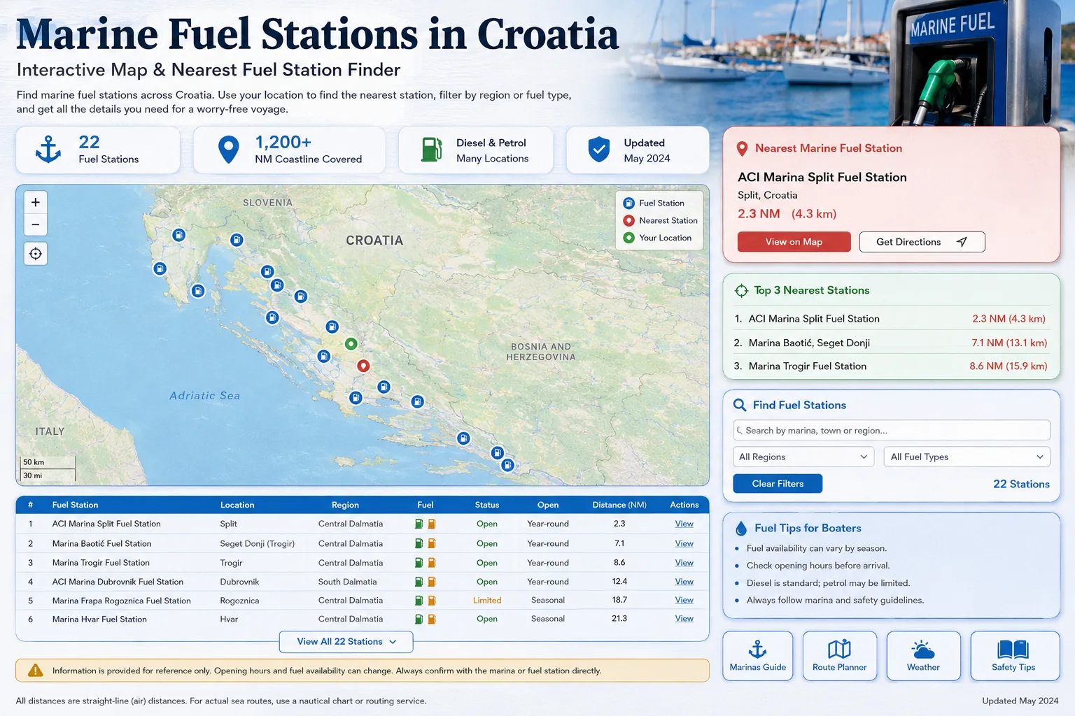
Use this interactive directory to find marine fuel stations along the Croatian Adriatic coast and islands. Allow location access to calculate the nearest fuel dock, compare straight-line distance in nautical miles, filter stations by region or fuel type and open the selected location in your preferred navigation app.
The map covers major refuelling points from Istria and Kvarner through Zadar, Šibenik, Split and the central Dalmatian islands to Korčula, Ploče and Dubrovnik. Everything runs directly in your browser. Your position is used only for the calculation on this page and is not sent to TwoBoat or stored on a server.
If you are planning an island-hopping itinerary, start with the Croatian Islands Sailing Guide to combine fuel stops with marinas, anchorages, weather and route planning before departure.
Interactive Croatia Marine Fuel Map
Nearest Marine Fuel Stations
The three closest locations will appear here after you permit location access. Distance is calculated with the Haversine formula and represents a straight line over the earth’s surface.
Location required
Press “Use my current location” above.
Complete Marine Fuel Station Directory
Use the search and filters above. When location access is active, the table is automatically sorted from the nearest to the farthest station.
| Station | Location | Fuel | Operator / contact | Opening information | Distance | Map |
|---|
How to Plan a Fuel Stop in Croatia
Do not wait for an empty tank
Plan the next fuel stop while you still have a safe reserve. Wind, waves, detours, harbour queues and a closed station can increase consumption or delay arrival. Before longer passages, review the Croatia sailing safety guide for Bura, Jugo, thunderstorms and practical passage-planning risks.
Expect Saturday queues
Charter return periods can create long queues around Split, Trogir, Kaštela, Biograd, Sukošan, Šibenik and other large charter bases.
Verify vessel access
A road fuel station near the sea is not automatically accessible by boat. Confirm the fuel berth, maximum length, depth, approach and whether assistance is available.
Check opening hours
Seasonal hours, Sunday schedules and weather restrictions change. Call the station before relying on a late arrival or an early departure.
Use nautical navigation
The map opens the geographical point, but it does not calculate a safe route around islands, shoals, restricted zones or harbour traffic. If you are unfamiliar with chart symbols, depths and hazards, use the interactive guide to reading nautical charts before planning the passage.
Keep a backup station
Identify at least one alternative fuel dock on the same route and maintain enough reserve to reach it safely.
Planning Fuel Stops Around the Croatian Islands
Fuel availability becomes especially important on island-hopping routes. Before leaving the mainland or a major charter base, identify the next reliable fuel dock and keep enough reserve to reach an alternative if the planned station is closed, crowded or difficult to approach.
Hvar
Vrboska is one of the key fuel options on Hvar. Use the Hvar Island Sailing Guide to compare fuel planning with marinas, bays, anchorages and route options around the island.
Brač
Bol is included in the fuel directory, while route choices around Brač depend on your next destination and weather. See the Brač Island Sailing Guide for marinas, bays, anchorages and skipper tips.
Korčula
Korčula and Vela Luka are important southern-Dalmatian fuel points. The Korčula Sailing Guide adds local marina, anchorage, provisioning and route-planning context.
Kornati
Fuel planning should be completed before entering more remote island areas. Use the Kornati Sailing Guide to plan services, anchorages and alternatives before entering the archipelago.
Use the TwoBoat route planner, compare marinas in Croatia, review the boat safety checklist and learn the basics of marine VHF communication.
Safe Refuelling Checklist
Before approaching
Prepare lines and fenders, identify the fuel filler, confirm the required fuel type and wait clear of manoeuvring vessels.
Before filling
Stop the engine, extinguish flames, prohibit smoking, switch off unnecessary electrical equipment and keep the crew ready to control the boat.
During filling
Keep the nozzle under control, prevent overfilling, watch tank vents and use absorbent material immediately if a spill occurs.
After filling
Close the cap, inspect the bilge and deck for fuel, ventilate enclosed spaces and only restart when there is no fuel smell or visible leak.
Frequently Asked Questions
How does the nearest fuel station function work?
After you approve browser location access, the JavaScript calculates the straight-line distance from your position to every station and sorts the results from nearest to farthest.
Is my location sent to the TwoBoat server?
No. The calculation runs entirely inside the browser. This implementation does not send or store the location on a TwoBoat backend.
Is the displayed distance a safe sailing route?
No. It is a straight-line distance. Always use current nautical charts and appropriate navigation equipment to plan the actual route.
How were the station coordinates checked?
The original marina-centre pins were replaced with researched fuel-pontoon coordinates from operator pages and current nautical location directories.
Can I use the map without allowing location access?
Yes. All stations remain visible and can be searched or filtered manually. Location access is needed only for distance sorting.
Do all stations sell both petrol and diesel?
The dataset uses the best available category information, but the current product range must be verified directly with the operator before arrival.
Can opening hours change during the season?
Yes. Summer, winter, Sunday and holiday schedules can differ. Weather and harbour operations can also affect access.
Can I open a station in Google Maps?
Yes. Every result includes a link using its latitude and longitude. The link identifies the point but does not replace nautical route planning.
Continue reading
Build your Croatia sailing knowledge with related TwoBoat guides, software, guides and planning tools.